Geological Map of Saint Helena
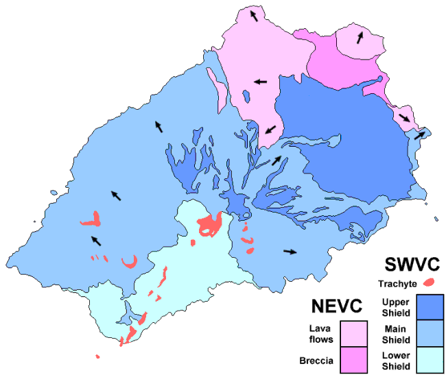
NEVC is the Northeastern Volcanic Centre, active between approximately 14 and 11 million years ago. Explosive submarine eruptions produced volcanic breccia which was subsequently lifted above sea level and covered by subaerial lava flows.
SWVC is the Southwestern Volcanic Centre, active between 11 and 7 million years ago. Lava flows of the Lower Shield were erupted between about 11 and 10 million years ago, of the Main Shield between about 11 and 9 million years ago, and of the Upper Shield between about 9 and 8 million years ago. The trachyte intrusions now exposed at the surface were emplaced between 8 and 7 million years ago.
Arrows show local direction of dip of lava flows.
Geological map of Saint Helena based on Baker (1968).
![]()
If you want some information about the comparitive composition of rocks from Ascension, St. Helena, and Tristan, and what it all means, go here. [Warning - esoteric but interesting!]
![]() Saint Helena Natural History page
Saint Helena Natural History page
Page maintained by Barry Weaver