Topographic map of Ascension Island
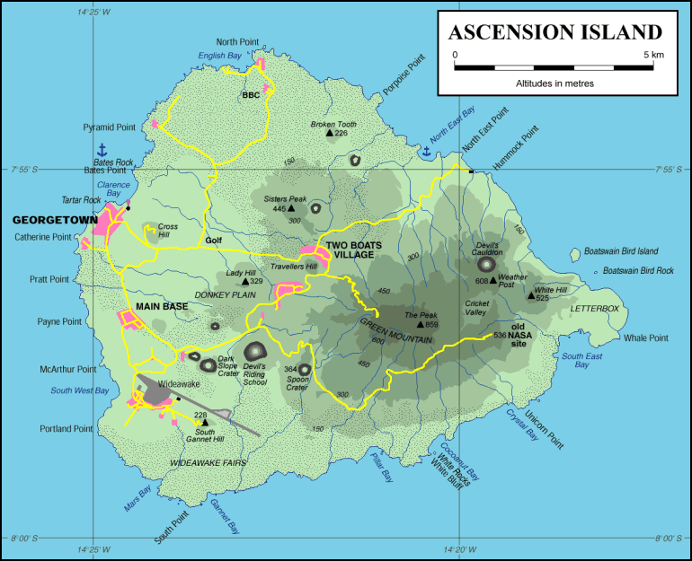
Image modified from a map produced, and kindly made available, by Jean-Pierre Langer.
The original map can be viewed as a zoomable Portable Document Format
(.PDF) file, but you need the Adobe Acrobat Reader ![]() to view this file.
to view this file.
A 1:25,000 topographic map is available as Ordnance Survey Series G 892, Ascension Island sheet, edition 4-GSGS, 1992.
Page maintained by Barry Weaver